| |
| Boundary Ridge Overlook - Apr 2009 |

|
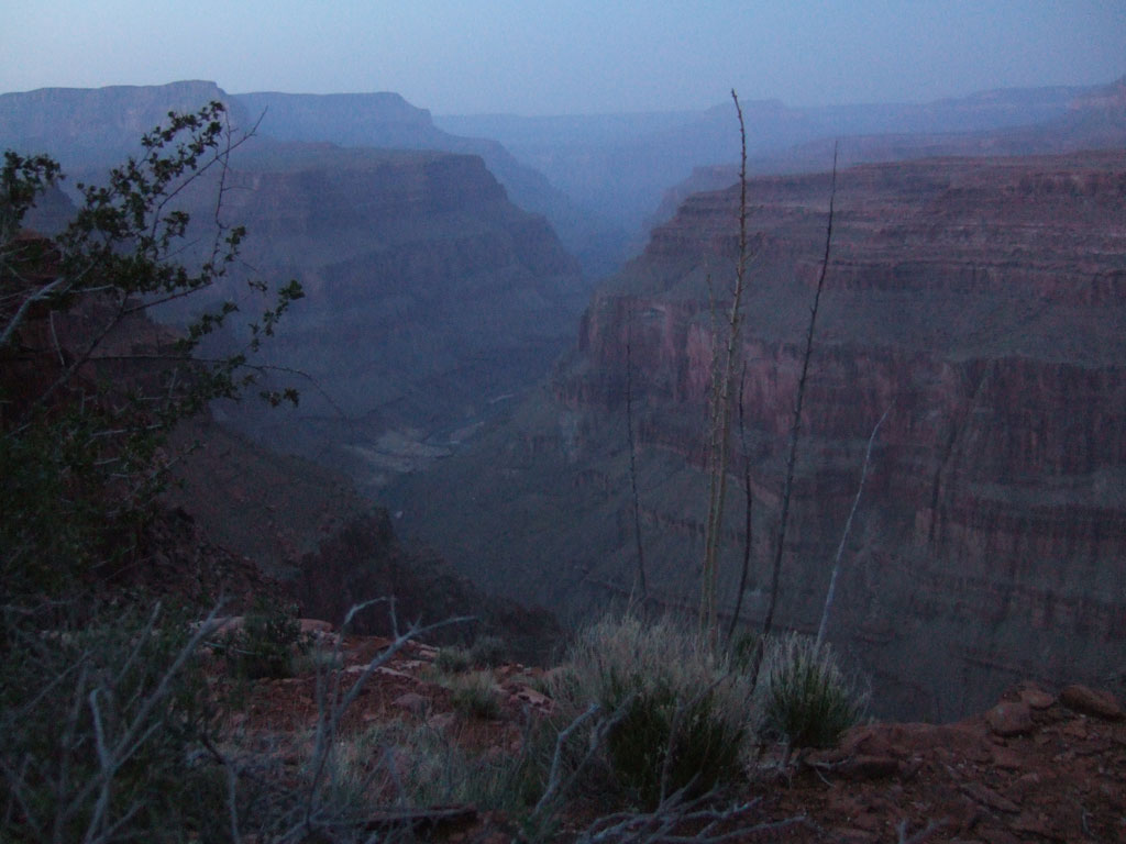
Simply the best viewpoint anywhere
at Grand Canyon and no tourist crowds or parking problems to
get here. This waterless plateau is some distance beyond the
end of rugged Trail 31 and should remain a place of perpetual
isolation and timeless solitude. The very end of Boundary Ridge
looking down the Marble Canyon corridor past Nankoweap delta. |
| View |
|
|
| |
| Sundown on the Esplanade above Fossil Delta - Apr 2008 |

|
A little grainy and maybe not up
to the best photo image quality but still an important one,
taken after sunset in a long exposure resting the camera on
my knee at the edge of the Esplanade looking down on Fossil
Canyon delta. We are at camp the 8th day out on a loop from
Royal Arch along the river, up Fossil, and now making our escape
with what water we have been able to collect from the head of
Fossil Bay -- not very much of it and just too much mineral
content to be good for us. |
| View |
|
|
| |
| High-Flow Experiment - Mar 2008 |

|
Below Eminence Break on the last
day of the high-flow experiment. On Sunday morning the flow
is decreasing. At the sun line on the river a research boat
is working a laser sounding system, motoring a line across the
river to measure the surface level and river depth -- the flood
having shifted things around underwater. Not very visible unless
you know what to look for -- at the bottom center of the photo
is a laser reflector tripod on a rock for a reference point
-- there are 2 others covering the eddy being surveyed. The
big boat is at the research camp on the beach upriver, and the
route is in the Redwall cliff above. This ramp is the Eminence
Break fault with an offset about 200 feet. The lowest place
on the skyline is where the fault continues to the rim. It's
extremely steep and we all have to be careful not to bump a
rock loose and tumble down onto someone. The research group
had been stationed here the whole week doing about the same
thing every day, and welcomed visitors -- glad to share campfire
conversation, food, and beer. |
| View |
|
|
| |
| Eminence Break - Sep 2007 |

|
This photo is from a weekend visit
to Eminence Break, about a half-day down and a half-day back
up with a few minor cliffs to negotiate and all very steep.
The fault is dramatic here because everything else on top is
so flat. The fault makes the "break" in the cliff
-- this photo is at the top couple-hundred feet in the Kaibab,
looking approximately southwest from the neck of Eminence Break/Tatahatso
plateau. The river is a little muddy -- it's just about 3,000
feet down from the rim. Just left of the river gorge the fault
continues and the top of the Redwall steps down to the west.
Landscape features visible include Point Hansboro on the inside
of the bend, Sase Nasket the near horizon, Boundary Ridge and
Saddle Mountain center-right far horizon. Some smoke shows from
a cluster of fires on Walhalla Plateau in the distance. |
| View |
|
|
|